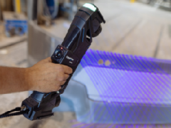
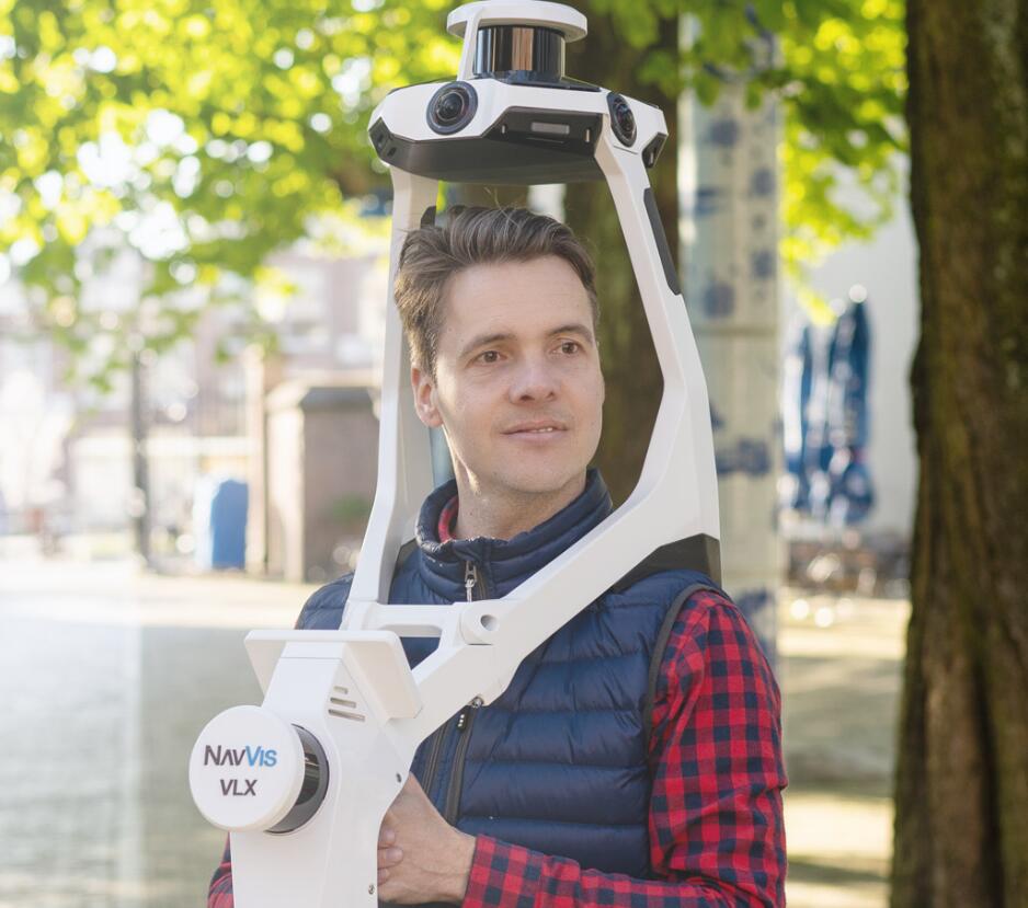
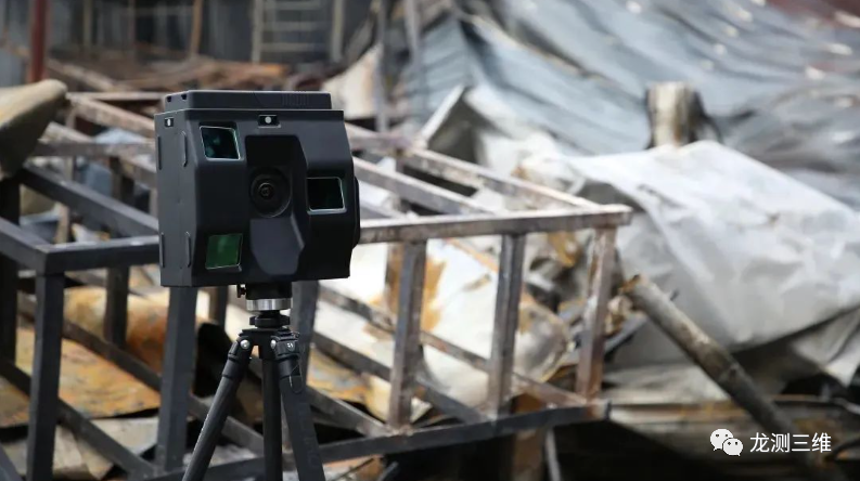
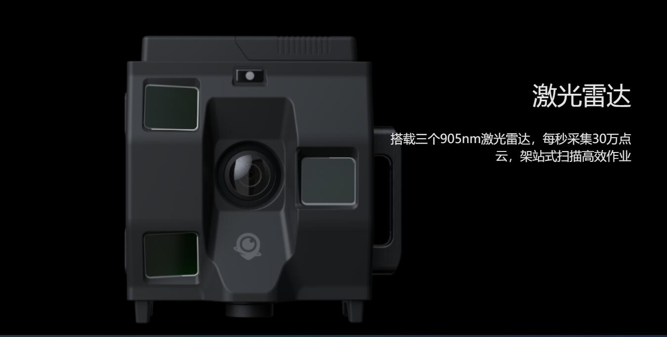
4D deep time is an indoor and outdoor surveying and mapping product with complete domestic independent intellectual copyright. It can replace similar foreign products in point cloud accuracy and panoramic picture quality. It is also the only ground surveying and mapping equipment with built-in access to the Beidou system in China. The four-dimensional deep time consists of a 16K fisheye lens and three 905nm Lidar to achieve better, faster and more secure 3D data acquisition without reducing the quality of the point cloud.
Performance advantage
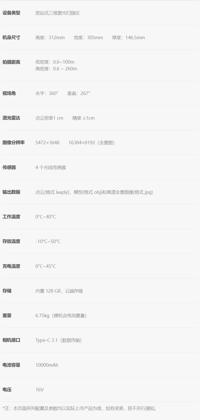
Modeling range up to 260m
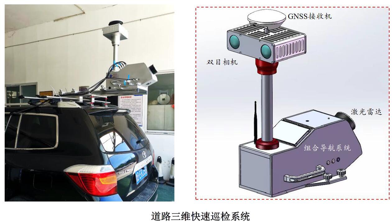
In terms of hardware, it is equipped with three 905nm lidar and three lidar of different angles at four-dimensional depth to construct the acquisition field of view Angle of 360° horizontally and 267° vertically, which makes the modeling range of a single station reach as far as 260m.
High precision point cloud ±1cm
Three multi-layer LiDAR sensors collect 3D measurement data and, combined with industry-leading laser positioning algorithms, generate a map-grade mass point cloud with an accuracy of ±1cm.
16K HD live image
In addition to high-precision point cloud data, the image quality of four-dimensional depth output has also been improved by leaps and bounds. High-definition fisheye lens can capture high-resolution images in an all-round way, and comprehensively output high-definition live images up to 16K.
30 seconds high-speed single station acquisition
With its unique structural design, four-dimensional depth time has obvious advantages in the acquisition speed, only 30 seconds to complete the single station data acquisition.
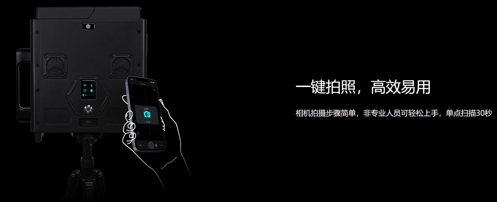
One key operation, easy to learn and easy to use
Zero basic users do not need professional training to use, one key speed scanning, the equipment automatically rotates 360° to complete the single station acquisition, namely sweep and go.
AI algorithm intelligent post-processing, automatic without human intervention
Based on the core self-developed algorithm technology, the realization of automation, intelligent three-dimensional digital modeling, completely give up the tedious manual operation, and avoid the results "vary from person to person".
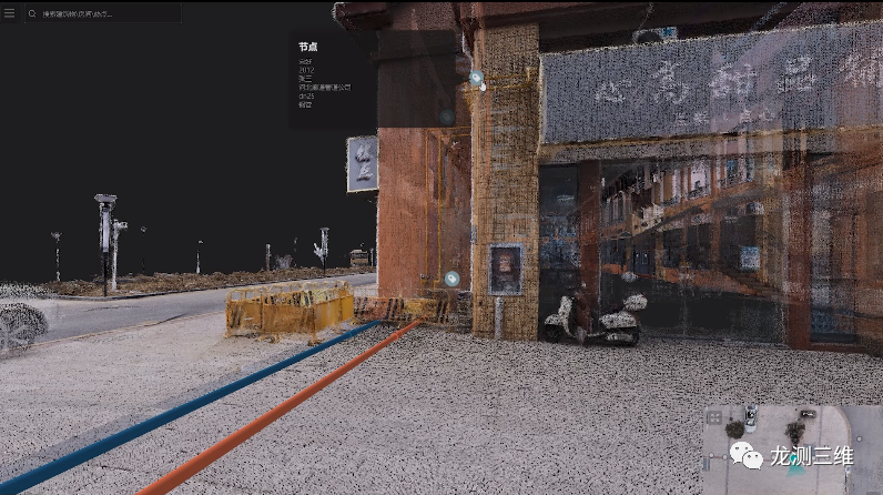
Five major editing blocks to create more three-dimensional space interaction
The calculation results of three-dimensional space can be independently edited in the five commonly used editing modules of "data set, hot spot, measurement, plane plan and coordinate" of the four-dimensional depth editing system to create a digital twin space with more communication value.
Technical parameter
Four dimensional deep time post-processing software
Four-dimensional deep time post-processing software can automatically process point cloud data and panoramic images without manual intervention, AI algorithm automatic modeling, providing standard point cloud data and OBJ model download.
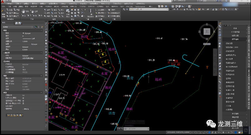
Data can be imported into surveying and mapping industry software
Support Autodesk series, CloudCompare, PCL and other professional software, create building BIM, establish building life cycle archives
 High precision measurement
Flexible measuring tools support accurate measurement of space distance and area
Add tag
Labels can be added at any location in the space to add spatial information to the real 3D data
 Space navigation
Indoor and outdoor path intelligent planning, automatic generation of navigation routes, accurate navigation
 Industry application
Building BIM
Four-dimensional depth is easy to operate, BIM engineers without knowledge of measurement can also easily complete data collection, and realize one-button point cloud processing, and support seamless connection with professional software related to building BIM, such as AutoCAD, to provide three-dimensional measurement solutions for the whole life cycle of building BIM.
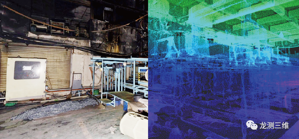
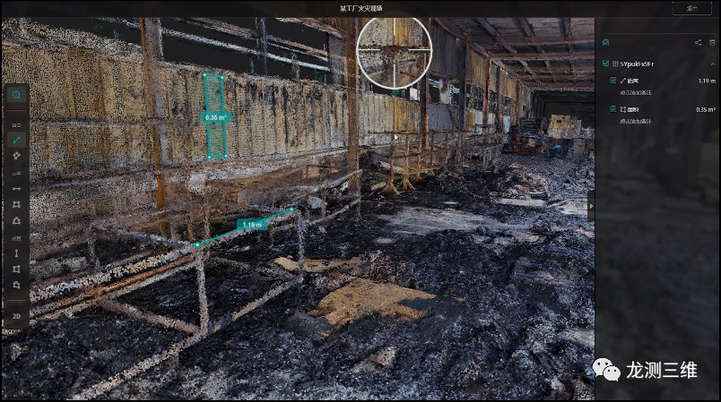
Fire criminal investigation
In public security affairs such as criminal investigation, fire protection and emergency response, four-dimensional depth can quickly obtain clear real scene images and accurate three-dimensional spatial information, restore the scene in a real and all-round way, and provide high-precision three-dimensional spatial position information. Through localized deployment, the field data is shared into the whole government system, and all relevant personnel can view and share the field data through the network, providing intuitive basis for case backtracking analysis and reporting.

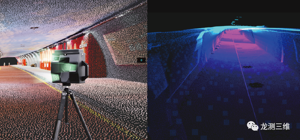
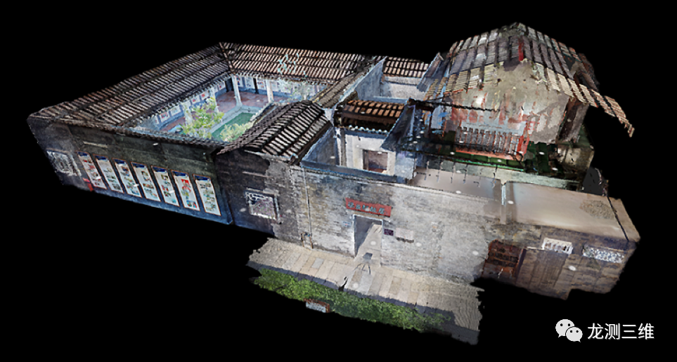
Surveying and mapping
With the implementation and promotion of the real 3D construction in China, the demand for city-level and component-level 3D data collection is increasing day by day. The digitalization, informatization and intellectualization of this kind of space is the development direction of the traditional survey and mapping. It can realize continuous, automatic and rapid accurate data acquisition of high-precision three-dimensional scenes without any positioning infrastructure in four-dimensional depth, which helps the construction of real three-dimensional scenes in China.
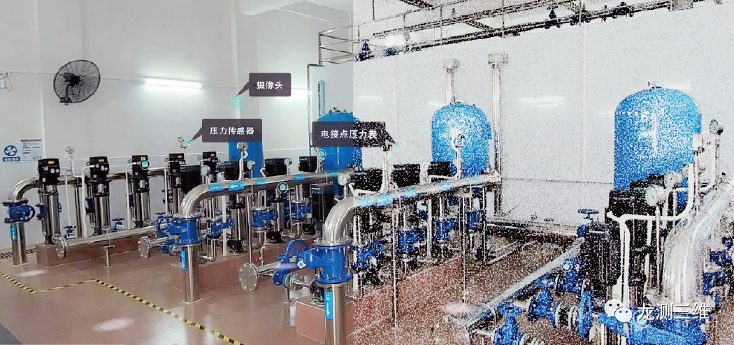
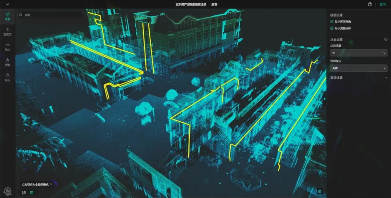
Underground space
The underground space is an important part of the safe and orderly operation of the city. The four-dimensional depth has the advantages of fast, efficient and easy operation, generating high-precision point cloud information and making the underground space "unobstructed". Three-dimensional visualization solutions can be provided for gas pipelines, oil and gas transmission stations, urban water supply and drainage, underground parking lots, civil air defense projects, etc., to promote the intelligent construction of "urban lifeline".
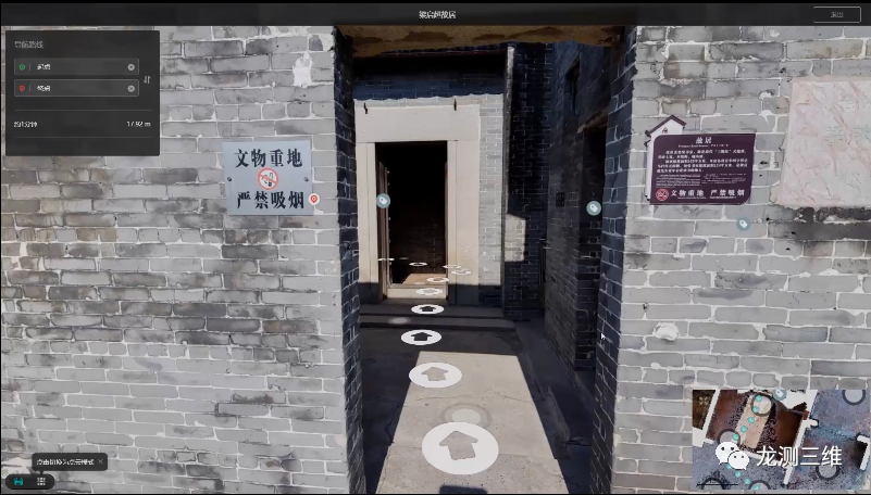
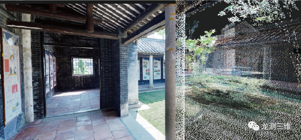
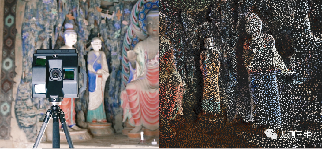
Culture, travel and culture
Surveying and mapping for the purpose of cultural relics protection and cultural transmission requires accurate reflection of the current situation of historical buildings, including damage, component misplacement, alteration, deformation, etc. High-precision reverse three-dimensional modeling and reconstruction technology is adopted in four-dimensional depth to quickly acquire three-dimensional information of large entities or real objects, and reconstruct its 3D data model through unique algorithm to reproduce real-time, dynamic and real characteristics of objective things.
 ∷
∷ 


 Sweep WeChat yards pay attention to us